
Sleeping Bear Dunes: Empire Bluff Trail

Buy the $.99 downloadable map!
(This map is not geo-referenced)Buy the Geo-referenced map
for use in the Avenza Maps App
Trail Details


Geo-referenced maps from MichiganTrailMaps.com are available through Avenza Maps and range from $1.99 to $2.99 each.
Download the Avenza app from the App Store or Google Play


Add six interpretive posts and an accompanying brochure that explains the natural and geological history of the area, and you have one of the best short hikes in the state.
The round trip is only 1.5 miles and in 2022, the park staff re-routed a small portion of the trail to soften the final slope at the end. But Empire Bluff is still rated moderate due to the amount of climbing involved. You also have to keep an eye out for poison ivy, commonly seen in the open areas along the way, and should definitely refrain from descending the sandy bluffs at the end since it will hasten erosion.
The trail is open year-round and makes for a far better snowshoe trek than it does for Nordic skiing, even with backcountry skis. Mountain biking is not allowed on the trail.
As a hike, Empire Bluff is an excellent choice for families and can be done by most people in under an hour. Pack along a lunch and enjoy it with a view that would rival any tableside view at Michigan’s finest restaurants. Better yet, bring a flashlight and arrive at near dusk on a clear evening for a sunset second to none.
| Difficulty - Moderate |
| Foot Path |
Click here to download an interpretive brochure for the Empire Bluff Trail.
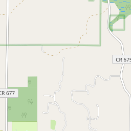
From the parking lot, the trail begins with an immediate climb past post No. 1, which marks an out-of-place boulder. Glaciers that picked up rocks and soil in Canada and the Upper Peninsula retreated from here 11,800 years ago, leaving the debris behind as bluffs, hills, and out-of-place boulders known as erratics. You move into a beech-maple forest that edges an old farm field and at post No. 2 can examine some old farm equipment left behind from the 1940s.
Another climb brings you to the crest of a ridge where the trail levels out passing two more posts and at 0.5 miles from the trailhead arrives at the first panoramic view of the hike where a bench allows you to sit and gaze on the Lake Michigan shoreline to the north.
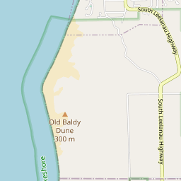
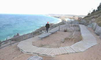
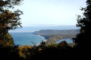
Eventually, you descend off the ridge, bottom out at post No. 5, and then make the final climb to post No. 6, where you break out of the forest to witness a spectacular panorama. It\'s a breathtaking sight for anybody who never envisioned such a reward at the end of such a short walk. You are more than 400 feet above the lake and can view Platte Bay to the south and the Sleeping Bear Bluffs to the north, with the famous Sleeping Bear Dune itself appearing as a small hill on top of the high, sandy ridge. Seven miles out on the horizon is South Manitou Island, and this entire picture is framed by dune grass and weathered trees.
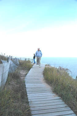
At this point, the trail swings south and follows a boardwalk along the bluffs for 500 feet to an observation area with a series of benches. Here is a hiker\'s bench with a view unmatched anywhere else in Michigan. You might have walked less than a mile but you could rest here for hours.
The trail is open year-round and all visitors are required to have a weekly vehicle entrance permit, an annual park pass or a per-person pass if they arrive on foot, bicycle or motorcycle. Passes can be purchased from the Philip Hart Visitor Center in Empire.
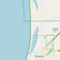
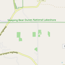
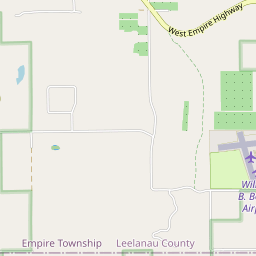
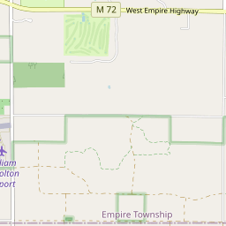
From the Philip Hart Visitor Center on the corner of M-22 and M-72 in Empire head south on M-22 for 1.7 miles and then west (right) on Wilco Road. The trailhead is to the left, a mile down Wilco Road.
Call the Philip Hart Visitor Center (231-326-5134) or check the Sleeping Bear Dunes National Lakeshore website (www.nps.gov/slbe). For travel information contact Traverse City Tourism (800-872-8377; www.traversecity.com)
Geo-referenced maps from MichiganTrailMaps.com range from $1.99 to $2.99 each.
Download the Avenza app from the App Store or Google Play
